Human factors testing results for Jeppesen Smart Airport Maps
Taxiing an aircraft can sometimes feel like a carefully choreographed dance—one misstep, and the whole routine can unravel. Between juggling ATC instructions, monitoring your surroundings and managing everything else on the flight deck, workload can build fast.
That’s exactly why Jeppesen FliteDeck Pro’s Smart Airport Maps underwent rigorous human factors testing—to see just how much these dynamic, data-rich maps could ease the load for pilots. Spoiler alert: the results were impressive.
And this wasn’t some academic exercise, either. The testing was built around the real-world challenges pilots face every day. The outcome? Smart Airport Maps don’t just look good in a demo—they deliver tangible cockpit and on-the-ground benefits when it counts most.
What are human factors tests?
Before we dive into the results, it’s worth clarifying what human factors tests actually measure.
In aviation, these tests evaluate how technology impacts the interaction between pilots and their environment. That includes:
Pilot workload
Situational awareness
Stress levels
Overall task performance
The mission? Simple but vital: ensure tools like Smart Airport Maps don’t just function—they actively make your job easier, safer and more efficient.
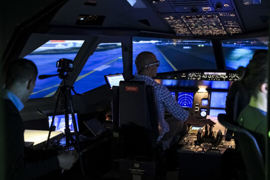
Human factors testing Smart Airport Maps in the Technical University of Wildau SIM.
Key findings from the human factors tests
Testing was conducted in realistic, high-pressure scenarios: low visibility, peak-hour congestion and complex airport layouts. Here are the game-changing insights that emerged:
1. Reduced pilot workload
One of the most dramatic takeaways was how much these maps reduced pilot workload during ground operations. Smart Airport Maps streamline so much of what we’d typically track mentally or with static digital charts. Instead of spending precious time double-checking taxi routes or updating ourselves on wingspan restrictions, the maps presented a real-time, comprehensive picture of the airport environment.
During testing, pilots reported spending significantly less time cross-referencing information, allowing them to focus on high-priority tasks like communication and decision-making. It’s not just about doing less—it’s about having mental bandwidth for the stuff that really matters.
2. Improved situational awareness
The enhanced situational awareness provided by the maps was another major highlight. Between the tailored wingspan guidance, and integrated low-visibility features, pilots consistently had a better grasp of their surroundings.
For example, during a simulated foggy departure from a complex international airport, pilots used Smart Airport Maps to immediately identify bottlenecks on primary taxiways and adjust their routes accordingly. This proactive awareness helps avoid delays while feeling confident in your spatial understanding of the airport.
3. Significant heads-down time reduction
Every second spent with your head buried in charts is a second you’re not watching your surroundings or actively managing the aircraft. That’s why the tests measured “heads-down” time (the time spent looking away from the outside environment or critical cockpit controls).
The dynamic nature of Smart Airport Maps meant pilots didn’t have to dig through multiple charts for information —it was all right there, in one customized map. This led to shorter, more efficient information-gathering sessions, leaving more time to focus on taxiing and external conditions.
4. Decreased stress levels
We’ve all felt the pressure that can come from ground operations in challenging conditions, whether it’s navigating peak-time traffic or dealing with unexpected changes to taxi instructions. But thanks to the clear, intuitive guidance from Smart Airport Maps, pilots in the study reported feeling far less stressed during these scenarios. And when we’re less stressed, we’re better equipped to handle whatever curveballs come our way.
5. Shorter taxi times
This one speaks for itself. The tests showed that using Smart Airport Maps resulted in shorter average taxi times across the board. By providing contextual information, the smart maps helped pilots taxi more confidently from gate to runway (and vice versa).
During peak-hour simulations at a busy international hub, pilots using Smart Airport Maps shaved an average of 12 seconds off their taxi times compared to those using traditional static digital charts. That’s not just an operational win—it’s a fuel savings win, too.
Real-world benefits of these results
Okay, so we’ve got reduced workload, better situational awareness and shorter taxi times. But what does all of this really mean out in the wild?
Smoother operations in complex environments
Imagine trying to taxi at a massive, congested airport like LAX. It’s early morning, the radio is packed, traffic is moving at a crawl and your departure is creeping closer.
With Smart Airport Maps, you’re not second-guessing your path. Instead, you get easy-to-understand, contextual guidance that boosts confidence and keeps things moving smoothly—even in the most complex layouts.
Fewer mistakes during stressful scenarios
High workload leads to errors—we’ve all been there. But with Smart Airport Maps delivering tailored visual information on your EFB, the risk of wrong turns, missed hold-short lines or taxiway incursions goes way down.
In fog simulations, pilots consistently followed compliant low-visibility routes without needing constant ATC reminders. The visual guidance acted like a safety net, helping everyone stay on the same page.
Time and fuel saved
Every saved second on the ground adds up. Time savings directly reduce fuel consumption during taxi operations—not to mention helping you stick to tighter schedules. Maybe you’ve got a connection to make, or maybe you’re just trying to avoid slipping into the penalty box on the tarmac. Either way, quicker, more efficient taxi routes are always a win.
Long-term impact on mental focus
Perhaps the most underrated benefit: cognitive relief.
By automating and simplifying so many low-level mental tasks, Smart Airport Maps give pilots the space to stay sharp through the entire flight. That pays dividends—especially on long-haul legs, late arrivals or busy turnarounds.
Final thoughts
The results from human factors testing send a clear message:Smart Airport Maps for FliteDeck Pro isn’t just a nice-to-have—it’s a transformative upgrade.
From easing workloads and reducing taxi time to lowering stress and boosting confidence during high-pressure operations, these maps are built for real-world flight decks and real-world pilots.
If you haven’t seen them in action yet, now’s the time. From pushback to parking, Smart Airport Maps help every part of ground ops feel more manageable, intuitive and safe. Contact Jeppesen’s sales team to learn how your airline can get started with Smart Airport Maps.