Seeing the Flight Path in a New Dimension: A Closer Look at the Enroute Profile View in FliteDeck Pro 5.3
FliteDeck Pro 5.3 is beginning to release and introduces the new Enroute Profile View for Enroute Intelligence subscribers. Here’s a detailed look at how it works and why it changes the way crews think about altitude and routing decisions.
Altitude decisions have always been one of the hardest things to visualize on a two-dimensional map. Weather, planned altitudes, and terrain all exist in the vertical dimension, but pilots have traditionally had to reconcile them mentally, cross-referencing a lateral map view against charts, other weather apps, and their flight plan to build a picture of what’s actually ahead along the climb, cruise, and descent.
The new Enroute Profile View in FliteDeck Pro 5.3 closes that gap. It gives pilots a cross-section view of the weather, route, and terrain in a single display, so altitude and routing decisions can be made with the full vertical picture in view rather than pieced together from separate sources.
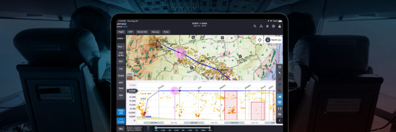
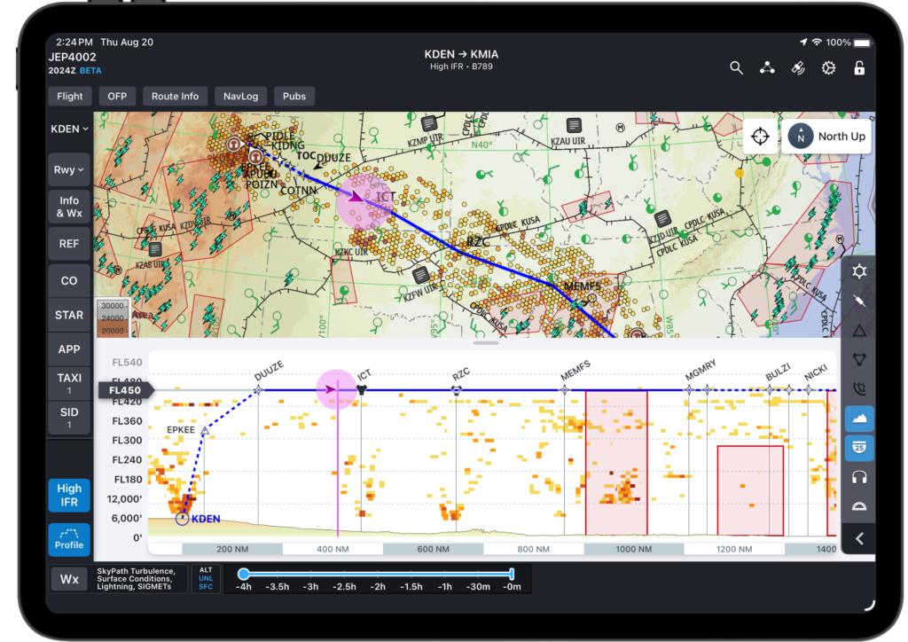
Enroute Profile View in FliteDeckPro 5.3 gives pilots a cross-section view of weather, route, and terrain with their ownship displayed at altitude on the Profile View.
Why a Cross-Section View Matters
Every flight plan carries a vertical story: step climbs and descents, terrain that rises and falls beneath the route, and weather that varies by altitude as much as by location. A lateral map view can show where a Significant Meteorological Information (SIGMET) or icing layer sits geographically, but it can’t easily show whether that weather sits above, below, or right at the aircraft’s planned cruise altitude.
The new Enroute Profile View in FliteDeck Pro 5.3 solves this by rendering the route as a side-on cross-section: distance along the bottom, altitude up the side. Terrain, weather, fixes, and the aircraft’s own position are all plotted against that same vertical scale, so a pilot can see at a glance if a forecast icing layer will actually be a factor at FL340, or whether a step climb clears a ridge line with room to spare.
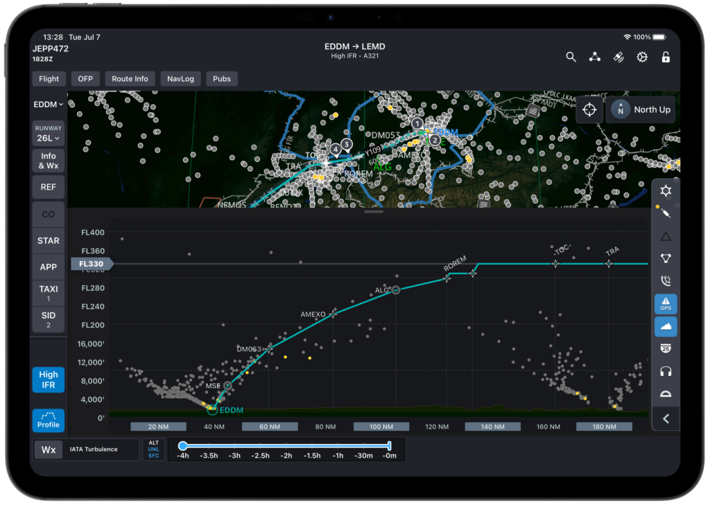
Enroute Profile View in FliteDeck Pro 5.3 displays IATA turbulence data in cross-section along the active route, helping crews spot and plan around hazardous turbulence before it’s encountered.
Getting to the Profile View
The Profile View lives inside the Enroute map. Once the Display Enroute Profile is turned on in FliteDeck Pro application settings, a Profile button appears on the Enroute map view. Tapping it opens the Profile drawer, which can be resized vertically by dragging the tab at the top, so pilots can give the view as much or as little screen real estate as the phase of flight demands.
Weather, Now in the Vertical Plane
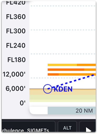
The Enroute Profile View displays weather layers based on a route corridor extending 20 nautical miles on each side of the route, so pilots see only what’s relevant to their actual flight path. Supported layers include:
Forecast Turbulence
SkyPath Turbulence, for subscribers
IATA Turbulence, for subscribers
Icing Potential
Winds and Temps Aloft
SIGMETs
Volcanic Ash Advisories
Layers appear and disappear in the Enroute Profile View in step with the same toggles used on the Enroute map, so there’s nothing new for users to learn or manage separately. Weather products without an altitude component, such as Radar and Echo Tops, aren’t applicable to a vertical cross-section and so don’t appear in the Enroute Profile View.
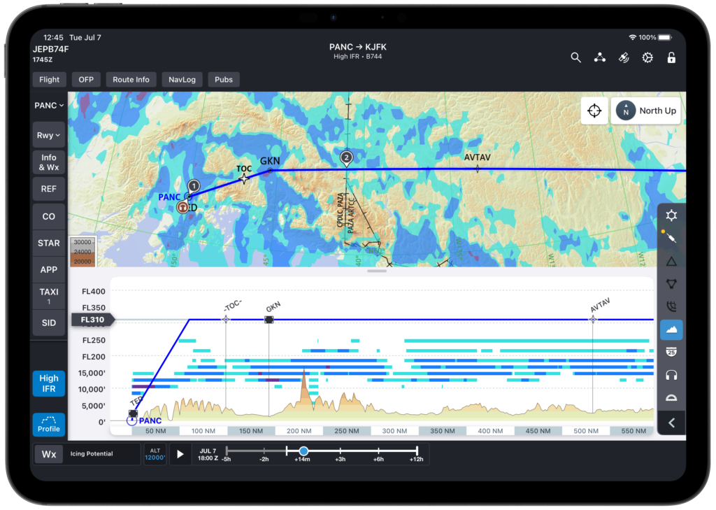
The Enroute Profile View in FliteDeck Pro 5.3 displays icing potential in cross-section along the active route, giving crews a clear view of icing risk by altitude before it becomes a factor in flight.
In the Profile View, FliteDeck Pro 5.3 shows Winds and Temps Aloft as numerical headwind and tailwind components based on the aircraft’s direction of travel, rather than the actual wind direction and speed shown on the standard Enroute map. For most crews, that’s a more directly useful representation: it speaks straight to fuel and time planning, without requiring a mental translation from compass wind to component wind.
Legends for any weather layer, on the map or in the Profile View, are always a tap away from the Wx button.
Terrain, Exactly Along the Route
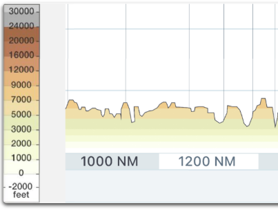
When the Terrain layer is active, the Enroute Profile View renders terrain data precisely along the route line, using the same banded gradient and contour intervals as the enroute map, so there’s no need to learn a second visual language. Unlike weather, terrain in the Enroute Profile View reflects the route itself rather than the wider corridor, giving pilots a precise read on what lies directly beneath the planned track, with sea level represented above the bottom edge of the display.
When the Terrain layer is turned on, FliteDeck Pro displays terrain data on the map and in the Profile View.
Every Fix, Right Where It Belongs
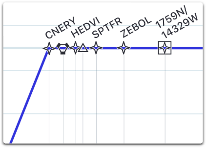
The Enroute Profile View plots the airports and fixes along the route using the same symbols and labels pilots already recognize, including compulsory and non-compulsory reporting points, user-defined and lat/long waypoints, VORs, VORDMEs, VORTACs, TACANs, and NDBs, along with ETPs, EEPs, and EXPs. SIDs display to the left of the route line and STARs to the right, each set off with a dotted line so departure and arrival procedures are easy to tell apart at a glance.
Enroute Profile View in FliteDeck Pro 5.3 displays airports and fixes from the route using symbols and labels.
Operators can also define an approved list of waypoints for the Profile View, giving flight ops teams and dispatchers finer control over exactly which points appear in the cross-section, keeping the display focused on what matters for a given operation rather than cluttered with every fix along the route.
Panning, Zooming, and Staying Oriented
The Enroute Profile View in FliteDeck Pro 5.3 is built to be manipulated in flight, not just glanced at. Pilots can pinch to zoom in or out, with the distance scale shown in tabs at the bottom of the drawer adjusting automatically. The largest scale shows the full extent of the route, while the closest zoom narrows to a 2 nautical mile view for detailed inspection of a specific segment. Dragging pans the view along the route, so a pilot can move from the current position to a point further ahead without losing context.
Pilots can pan and zoom the Enroute Profile View in FliteDeck Pro 5.3 to focus on areas of interest along their route.
Where the Aircraft Actually Is
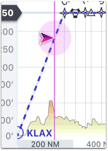
Ownship position displays as a moving or static symbol directly on the cross-section, giving crews a real-time read on their vertical position relative to terrain and weather. The symbol behaves predictably at the edges of relevance: it begins to fade starting at 20 nautical miles laterally from the route and disappears entirely at 50 nautical miles. Ownship doesn’t display at all if the aircraft is beyond either end of the route, keeping the display honest. The ownship symbol only appears when it’s actually meaningful to the current route segment.
The Enroute Profile View in FliteDeck Pro 5.3 displays your ownship position as either a moving or static symbol on the cross section.
Scaling the View Around Cruise Altitude
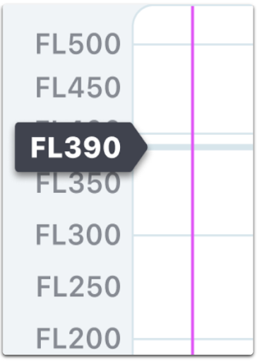
The cruise altitude slider controls the vertical scaling and extent of the Enroute Profile View, and it’s designed to require as little manual input as possible. By default, it reflects the flight planned cruise altitude from the 633 flight plan when that data is available. When it isn’t, the Enroute Profile View falls back to FL350 for eastbound flights and FL360 for westbound flights, consistent with standard hemispherical cruise altitude conventions.
Use the cruise altitude slider to adjust the vertical view scaling and extent of the Enroute Profile View in FliteDeck Pro 5.3.
Altitude adjusts in 1,000 foot increments, up to a maximum of FL550 and down to a minimum of 1,000 feet. Dragging the slider compresses or expands the vertical scale in real time; releasing it snaps the window back to its default size and rescales the display. At every setting, the view maintains a minimum of 10,000 feet of data above the selected cruise altitude, so pilots always have visibility into what’s above their planned altitude, not just what’s at or below it.
Flight Plan Altitude Data, Automatically
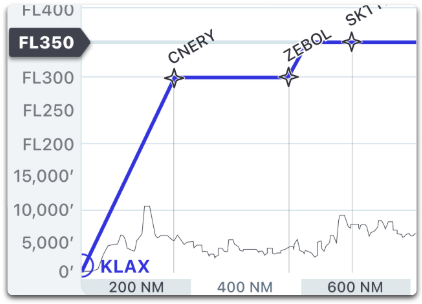
When a loaded flight plan includes altitude data, the Profile View reflects it directly, including SID/STAR altitudes and stepped climb or descent segments, with stepped segments beginning precisely at their associated fix. This data is for reference. Planned altitudes can’t be modified from within the Profile View drawer, keeping flight plan changes routed through their proper channel.
When a loaded flight plan includes altitude data, FliteDeck Pro displays that data in the Enroute Profile View.
If the flight plan’s cruise altitude doesn’t match any segment on the planned route, FliteDeck Pro defaults to using the longest segment in the route as the displayed cruise altitude, so the view always resolves to something sensible rather than leaving a gap.
A More Complete Picture, Built for the Flight Deck
Individually, none of these details are complicated. Terrain along a route, weather in a corridor, fixes with labels, an altitude slider. Together, they form a single view that answers a question pilots have always had to assemble by hand: what does the vertical path ahead actually look like, right now, for this flight?
The new Enroute Profile View in FliteDeck Pro 5.3 is dropping in the App Store soon for operators subscribed to Enroute Intelligence. To see it in action, request a demo from the Jeppesen ForeFlight team.